Posted on September 6th, 2016
Post-tropical cyclone Hermine continues to linger off of the coast far enough away that we aren’t seeing any rain, but close enough that we are experiencing higher than normal tides and some residual winds. Onshore today it was blowing out of the NW from 15-20 knots with some gusts almost reaching 30 knots, but that is forecast to subside as Hermine slowly drifts further offshore.
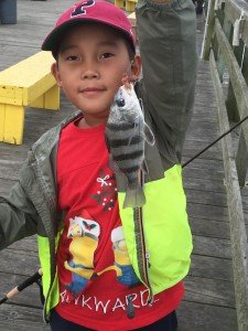
I’m pretty certain nobody ventured into the ocean again today, but anglers are fishing the back bays hoping for the water to clean up a little. Bear at the Oceanic Pier sent me proof that people are actually fishing and there are some fish being caught. This junior angler caught a small black drum on bloodworm from the pier this morning. It’s not much, but it’s a good sign.
The party boat fleet may be giving it a go on Thursday, and based on the forecast the offshore fleet will hopefully be in the canyons before the weekend. I know that everybody is chomping at the bit to get fishing so they’ll be going as soon as they can. Here are the forecasts for inshore and offshore waters.
Coastal waters from Fenwick Island, DE to Chincoteague, VA out 20 nautical miles.
Tonight
NW wind 10 to 13 kt. Isolated showers. Seas around 5 ft.
Wednesday
W wind 8 to 13 kt. Partly sunny. Seas 4 to 5 ft.
Wednesday Night
WSW wind around 11 kt. Partly cloudy. Seas around 3 ft.
Thursday
W wind 7 to 11 kt becoming SSW in the afternoon. Partly sunny. Seas 2 to 3 ft.
Thursday Night
SSW wind around 14 kt. Mostly cloudy. Seas around 3 ft.
Friday
W wind 7 to 9 kt becoming SSW in the afternoon. Partly sunny. Seas around 3 ft.
Friday Night
SW wind around 10 kt. Partly cloudy. Seas around 2 ft.
Saturday
SSW wind 9 to 14 kt. Mostly sunny. Seas 2 to 3 ft.
Saturday Night
SSW wind around 16 kt. Partly cloudy. Seas around 4 ft.
Baltimore Canyon to Cape Charles Light to 100 nautical miles from shore
TONIGHT
W TO SW WINDS 15 TO 25 KT…BECOMING W TO NW 10 TO
20 KT. SEAS 6 TO 11 FT…EXCEPT SW PORTION 4 TO 6 FT…HIGHEST
NE. SCATTERED SHOWERS AND CHANCE OF TSTMS N PORTION.
WED
NW WINDS 10 TO 20 KT…BECOMING W 5 TO 15 KT. SEAS
BECOMING 3 TO 6 FT…HIGHEST NE.
WED NIGHT
W TO SW WINDS 10 TO 20 KT. SEAS 3 TO 5 FT.
THU
W TO SW WINDS 5 TO 15 KT. SEAS 2 TO 4 FT. SCATTERED
SHOWERS AND TSTMS.
THU NIGHT
SW WINDS 10 TO 15 KT…BECOMING 10 TO 20 KT. SEAS 3
TO 5 FT.
FRI
W TO SW WINDS 5 TO 15 KT. SEAS 3 TO 5 FT.
FRI NIGHT
SW WINDS 10 TO 15 KT. SEAS 3 TO 5 FT.
SAT
SW WINDS 10 TO 15 KT…BECOMING S TO SW 15 TO 20 KT. SEAS
3 TO 4 FT.
SAT NIGHT
S WINDS 15 TO 20 KT…BECOMING SW 15 TO 25 KT. SEAS
4 TO 6 FT.
SUN
SW WINDS 10 TO 20 KT. SEAS 3 TO 5 FT.
SUN NIGHT
WINDS BECOMING N 10 TO 20 KT. SEAS 3 TO 5 FT.

